
1763
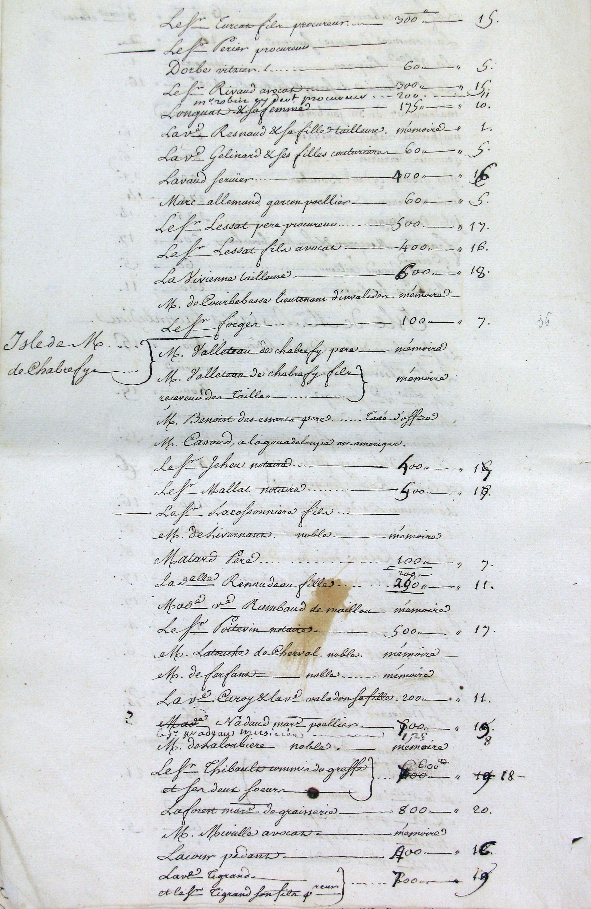
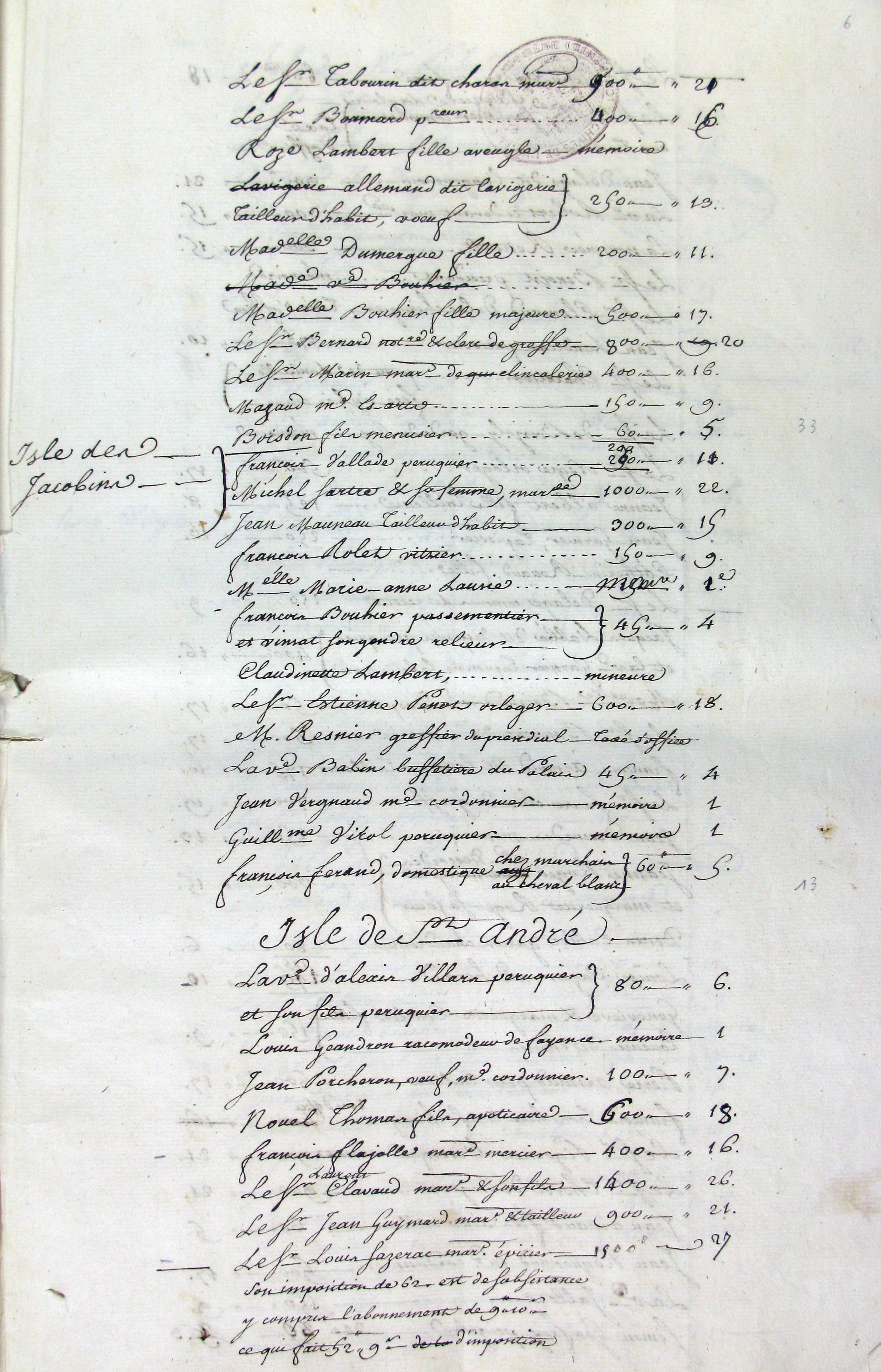
The “Cahiers de l’etat des classes faites pour la faction du role pour 1763,” AM-A, CC42, drawn up in preparation for the tax roll of the town, provides information, over 64 pages, about householders (heads of household, both proprietors and tenants) in the town and the surrounding villages, together with their income and the tax “class” to which they were assigned. The occupations of many householders are also listed, sometimes with the occupations of their wives or husbands. The householders in the central parishes are listed by the “island,” or group of contiguous houses, in which they lived. These are the listings for the Isle de la Cloche Verte, also known as the Isle de M. de Chabrefy, which was partly in the parish of St Antonin and partly in the parish of St André. It was bounded by the Rue de la Cloche Verte, the Grande Rue du Palais (now the Rue des Postes and the Place de l’Hotel de Ville) and the Petite Rue du Palais (now Rue Ludovic Trarieux.) The bridegroom in the marriage contract of 1764 lived in the island, as did eighteen of the signatories of the contract.
J. George, Topographie historique d’Angoulême (Angoulême, 1899) ; Emma Rothschild, An Infinite History: A Family in France over Three Centuries (Princeton, NJ, 2021).
 |
 |