
« 1791
Data »
PLAN
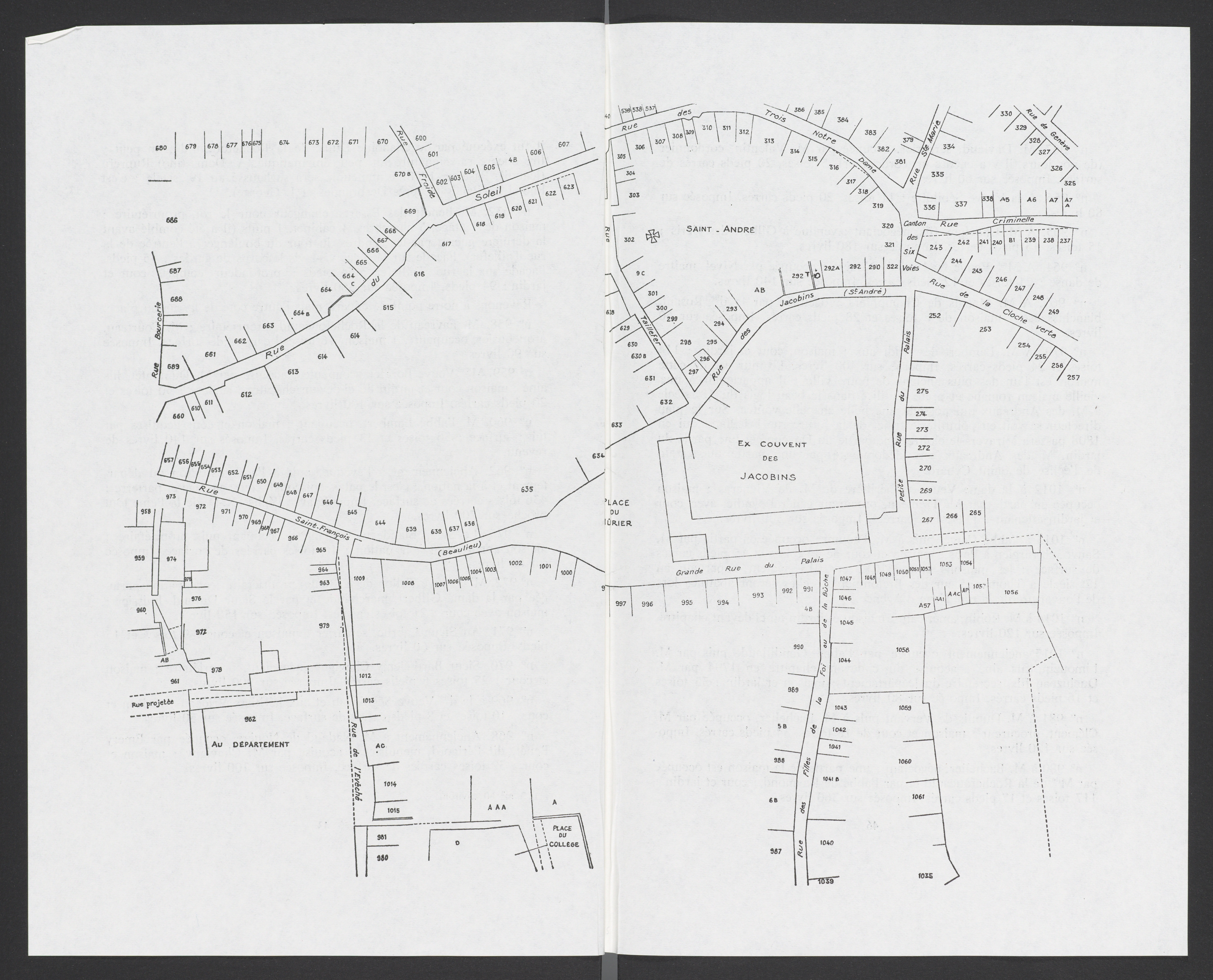
The house numbers in the tax register of 1791 correspond to a remarkable map of the entire central part of the town, the “Plan Directeur” of 1792, showing the names of all the streets and the numbers of all the houses, which now hangs on the wall of the entry to the Archives Municipales d’Angoulême. This is the portion of the map which shows the houses in the former Isle de la Cloche Verte. The drawing of the map was prepared by Henri Baranger, in James Forgeaud, « La Place du Murier et ses environs, » Bulletins et mémoires de la société archéologique et historique de la Charente BSAHC (1987), 37-70.
 |
 |